18 March 2024
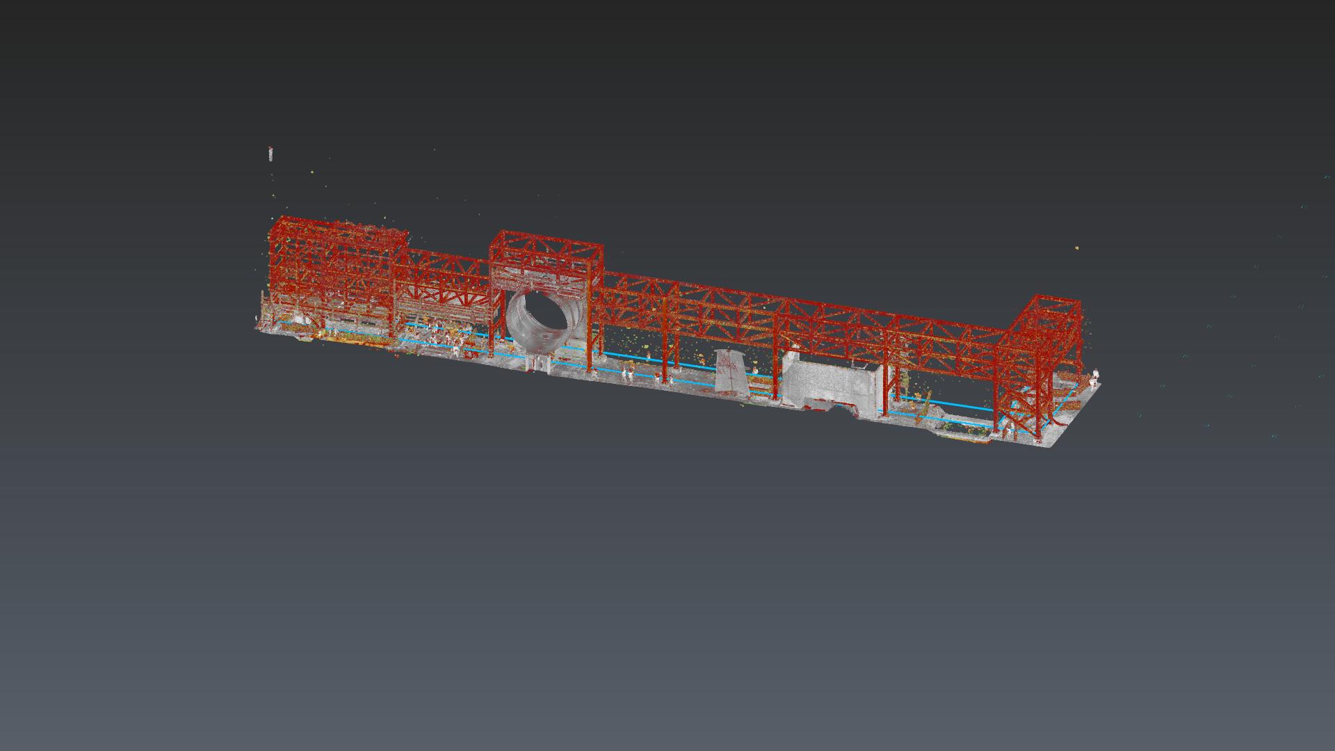
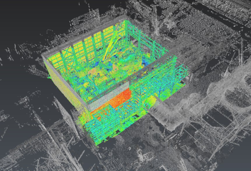
The aim of the assignment is to provide topographical assistance in order to ensure the correct placement according to the project of: concrete structures, the
skid base and the placement of steam turbines and Share Keys.
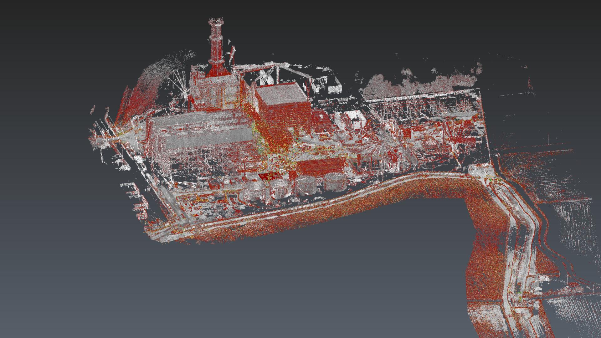
To provide the required accuracy and precision we setup a unique
reference system within which both the Leica Nova TS60 Total Station and the Terrestrial Laser Scanner System RIEGL VZ600-i are acquiring data. This allows
the inspection of the flatness and the height of the project elements.
The integration between Terrstrial Laser Scanner System and Total Station systems allows to check the correct positioning of the works (share key, structural elements, skid base, steam turbine etc...) in a short time and with the required precision.
The integrated survey enables the creation of a digital twin that enables precise and targeted inspections.
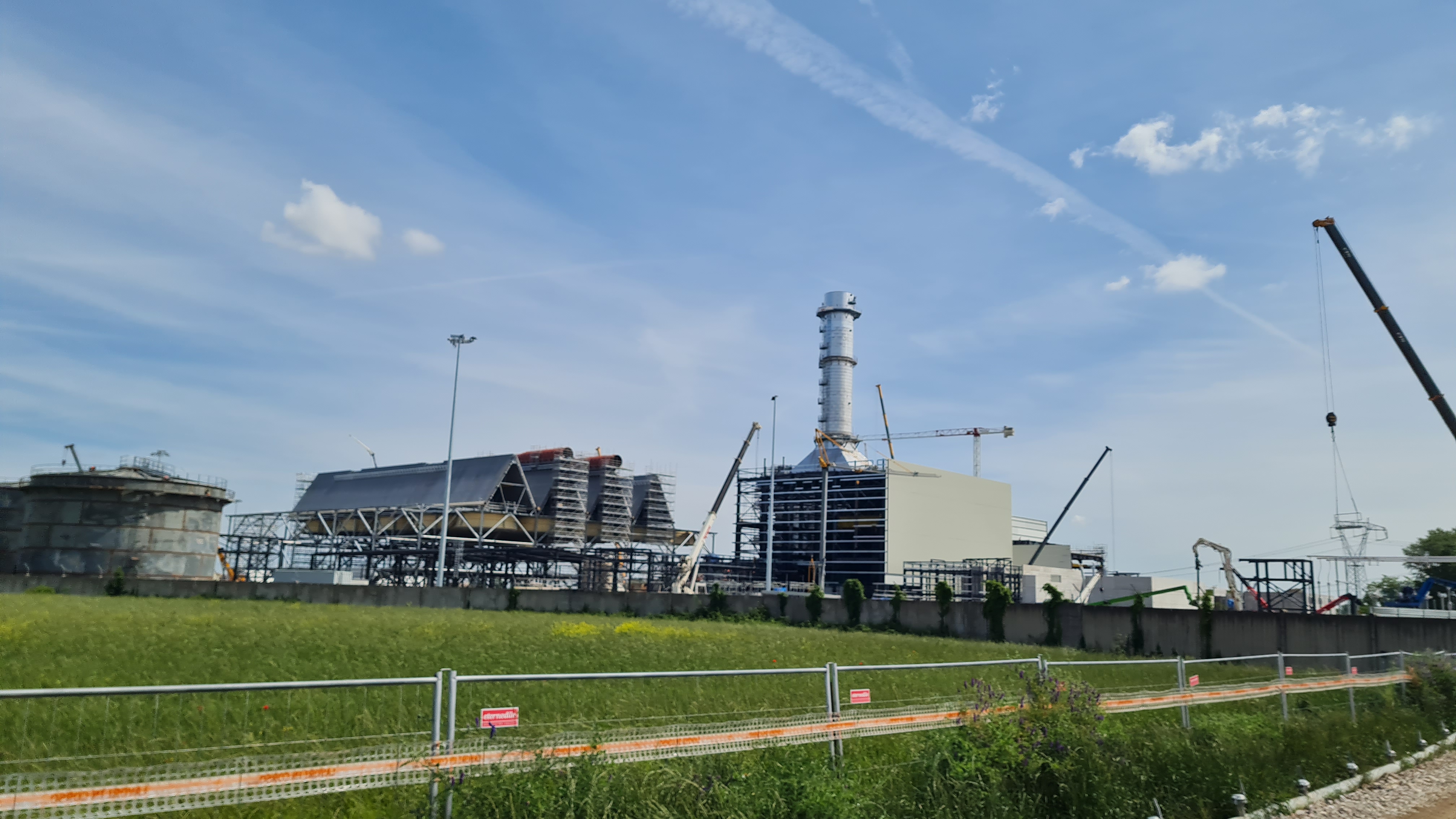
- Project: Topographical site assistance
- Client: Demont
- Location: Ostiglia (MN)
The following equipment was used to carry out the work:
- MecGeos Remote Control
- Total station Leica Nova TS60 0.5"
- Laser scanner RIEGL VZ-600i
The following softwares were used to process the work:
- Leica Captivate
- RiScan pro
- Leica 3DR Cyclon